Global Defence Agency OSINT tool
G.E.O.S Sentinel: Live Military Tracker & Global Conflict Map
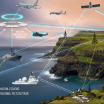
G.E.O.S Sentinel (Global Events & Operations Surveillance Sentinel) is a free, live open-source intelligence map of the world's military activity. One interactive 3D globe brings together military flights, navy warships, military bases, NOTAM danger areas, military satellites, GPS jamming and breaking security incidents, so analysts, journalists and defence enthusiasts can see what is happening and where, as it happens.
What you can track on G.E.O.S Sentinel
Military flight tracker
Follow military, government and special-mission aircraft that broadcast ADS-B, including tankers, ISR and maritime patrol aircraft, with live headings and trails.
Naval vessel tracker
See navy warships from a curated watch list on live AIS, with recent port calls and gaps where a ship switched its transponder off.
Military bases
Toggle air force and drone bases, naval bases, army garrisons and strategic sites, with full coverage of Pakistan and India.
NOTAMs and NAVAREA warnings
India and Pakistan military NOTAMs and navigational warnings for firings, missile tests and exercises, drawn in their exact shapes and removed on expiry.
Air-route closures
Only the closed segments of air routes named in route-closure NOTAMs are shown, so you can see airspace shut for drills at a glance.
Breaking conflict events
Strikes, blasts, terror attacks, attacks on ships, shoot-downs, piracy, air crashes, North Korean missile launches and PLA activity around Taiwan, plotted where they happened with a link to the source.
Military satellites
Track reconnaissance and military satellites of the US, Russia, China, India, Pakistan, Israel, France, the UK, Italy, Germany, Türkiye and Iran, plus the ISS and China's Tiangong station.
GPS jamming and spoofing
A daily hexagon map of GNSS interference built from aircraft navigation-accuracy reports, highlighting jamming hotspots around conflict zones.
Missile range finder
Pick a ballistic or cruise missile and see its published range drawn from any launch point on the globe.
Nuclear effects
Visualise blast, thermal and radiation radii for a chosen yield to understand the scale of strategic weapons.
How the live data works
Everything on the map comes from public, open sources. Aircraft and ship positions stream live from ADS-B and AIS broadcasts. Breaking incidents are gathered every hour from major news agencies and placed at the exact location of the attack or accident, with duplicates and follow-up stories filtered out. Military NOTAMs and NAVAREA warnings for India and Pakistan are checked every two days and redrawn whenever they are issued, updated or cancelled. The GPS interference layer is rebuilt daily.
Country status levels (crisis, elevated, watch and stable) are editorial judgements by the Global Defence Agency desk. Read our in-depth naval analysis and naval aviation coverage for the stories behind the map.
Frequently asked questions
What is G.E.O.S Sentinel?
G.E.O.S Sentinel (Global Events & Operations Surveillance Sentinel) is a free, live open-source intelligence (OSINT) map from Global Defence Agency. It brings military flights, navy ships, military bases, NOTAMs and NAVAREA warnings, military satellites, GPS jamming and breaking security incidents together on one interactive 3D globe.
Is G.E.O.S Sentinel free to use?
Yes. The map is free and needs no account or sign-up. Open the page in any modern browser on desktop or mobile.
How often is the data updated?
Aircraft and ship positions stream live. Breaking incidents from major news agencies are checked every hour, India and Pakistan military NOTAMs and NAVAREA warnings every two days, and the GPS interference layer is rebuilt daily. Expired warnings are removed automatically.
Where does the data come from?
Only public sources: open ADS-B flight data, AIS ship broadcasts, published NOTAMs and navigational warnings, public satellite orbit data, and reports from major news agencies such as Al Jazeera, BBC, CBC and Reuters. Each incident on the map links to its source.
Can I track military aircraft and warships in real time?
Yes. The aircraft layer shows military and government flights that broadcast their position, and the naval layer shows navy vessels from a curated watch list using live AIS data. Ships and aircraft that switch off their transponders will not appear while dark.
Does it show NOTAMs and missile test areas for India and Pakistan?
Yes. Military NOTAMs and NAVAREA warnings for firing exercises, missile tests and drills are drawn in their exact published shapes, including closed air-route segments, and disappear when they expire.
Is the information official advice?
No. Country status levels are editorial judgements by the Global Defence Agency desk, and incidents are open-source reports that may be unconfirmed. Borders are shown for orientation only. Do not use the map for navigation or safety-of-life decisions.
Developments are open-source reports and may be unconfirmed. Borders are shown for orientation only. Not for navigation or safety-of-life use.